Sunday Creek Extension EPM 18361 granted 28th February 2011

OMODEI MINING ENTERPRISES
BN 18862986
Resources Exploration, Mining, Infrastructure & Development

Sunday Creek Extension (SCE) EPM 18361
Sunday Creek
Extension Update
to June 2014
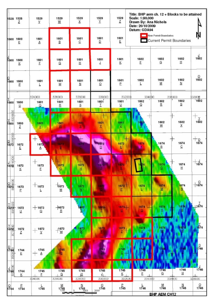
 EPM 18361 Far North Queensland")
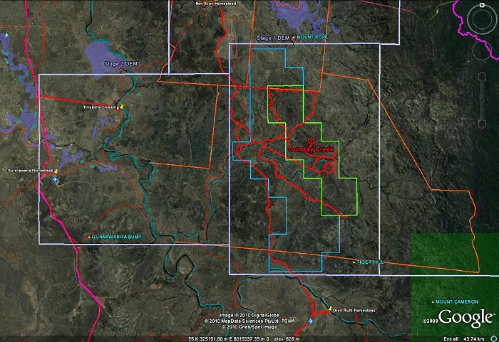
Area planned for detailed DEM (Digital Elevation Model) of Whispering Ridge MDL 298, completely surrounded by Sunday Creek EPM 15896 (in Green) and Sunday Creek Extension EPM 18361 (in Blue) area. (Prospects covering approx 145 Square Klms) overlaid on Google Earth.
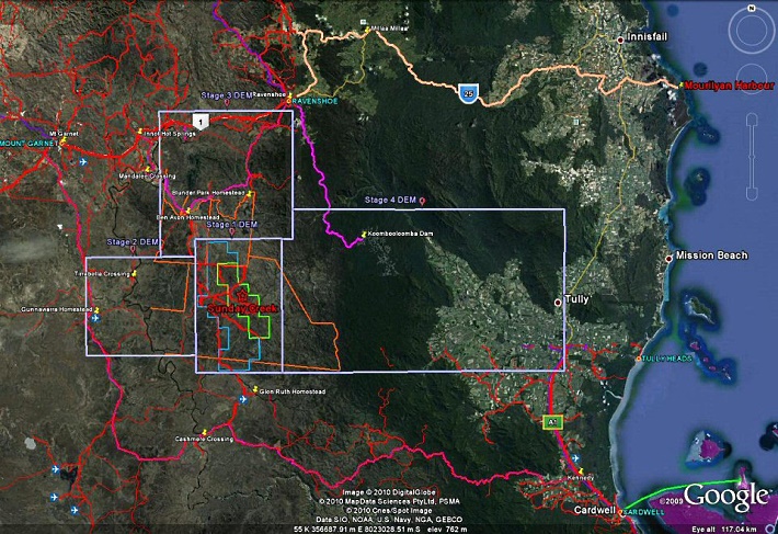
Proposed inital planning of stage areas of DEM (Digital elevation models) for exploration, mining, associated infrastructure and downstream industrial development under review for LiDAR Whispering Ridge / Sunday Creek Industrial Corridor-Slurry Pipeline and transporatation alternatives to Mourilyan Harbour / Townsville port for Magnetite and other Mineral Ores Far North Queensland Australia.
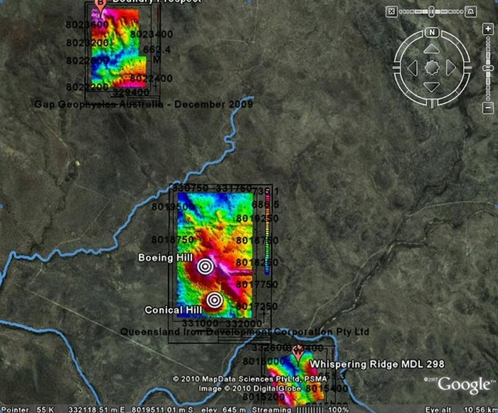
Accurate terrain data collected from SAM (Sub audio magnetics) from DEM (Digital elevation models) Survey Results to show detail DEM comparing work at between MDL 298 and EPM 15896 overlaid on Google Earth Image Boundary-Jurassic captured December 2009 interpreted March 2010 to Sunday Creek captured 2008 interpreted 2009 and Whispering Ridge captured 2007 interpreted 2008
Three prospects now
held in Far North
Queensland
